


What if the true luxury of a city were not height, speed or spectacle, but freedom — the freedom to walk beneath trees, for children to play safely, for older people to remain connected, and for everyday life to unfold with dignity? Cities are often discussed through numbers: population, density, infrastructure capacity, investment, square metres

18
Mar
Mar
One of the most common mistakes in discussions about megacities is to equate “mega” with population size. A city does not become effective simply because it gets bigger. It only becomes powerful when scale is converted into productivity: more job opportunities, better labor matching, faster knowledge spillovers, and urban services that function efficiently at scale.

22
Jan
Jan
Dr Liu Thai Ker (刘太格) has passed away at the age of 87. Lui Thai Ker laid the groundwork for Singapore’s urban development and planning approach. He established the Housing Development Board (HDB), a government body that provides highly affordable homes—averaging just four times the household income—to nearly 80% of the population (once reaching as

29
Dec
Dec
Context Located at a strategic gateway position, Sapa Tea Hills sits along a key connective axis, serving both as the first stopping point for visitors approaching Sapa and as a junction leading to surrounding villages, valleys, and sacred mountain peaks. This context sets a clear requirement: the project cannot develop as a closed enclave, but

15
Dec
Dec
Context A New Waterfront Gateway for Phnom Penh Koh Norea occupies a strategic 70-hectare waterfront site at the meeting point of the Mekong and Bassac Rivers, positioned between Phnom Penh’s established urban core and its expanding eastern districts. With approximately 1.44 kilometres of waterfront frontage, the site benefits from panoramic views towards Diamond Island New

23
Oct
Oct
From Singapore to Sydney, many global cities are “returning” their riverfronts and former port areas to the people. Converting industrial docks into parks and public squares not only expands green spaces but also enriches urban identity and livability. Ho Chi Minh City’s recent decision to halt a real estate project on the 31-hectare Nha Rong

04
Aug
Aug
I once participated in a project aimed at addressing lead water contamination in Malden, Massachusetts, a city of approximately 70,000 residents. Our mission was to map heavily contaminated areas and propose a phased action plan. Working alongside local officials, we integrated lead contamination maps, hosted on an accessible online platform, with spatialized demographic data including
16
Jul
Jul
I believe that one of mankind’s first discoveries was not fire or a wheel, but the ability to transform nature, the ability to use the hands and build, contradicting gravity. Our primal need is shelter, so we dig a hole, and with the earth we extract, we build a wall. And while digging, we are
24
Mar
Mar
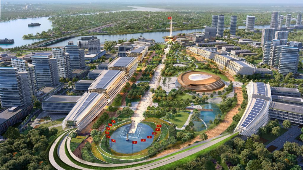
Biên Hòa Đông Phố is poised to become a vibrant administrative and commercial hub, seamlessly integrated with TOD principles. This visionary urban model champions net-zero emissions, fostering a sustainable synergy between urban architecture and the natural landscape, characterized by an expansive green space network connecting urban squares and parks to the Dong Nai River. A confluence of Heritage, Innovation, and Ecology, this development will redefine Biên Hòa as a premier destination for living and working within the Southeast region.
17
Mar
Mar
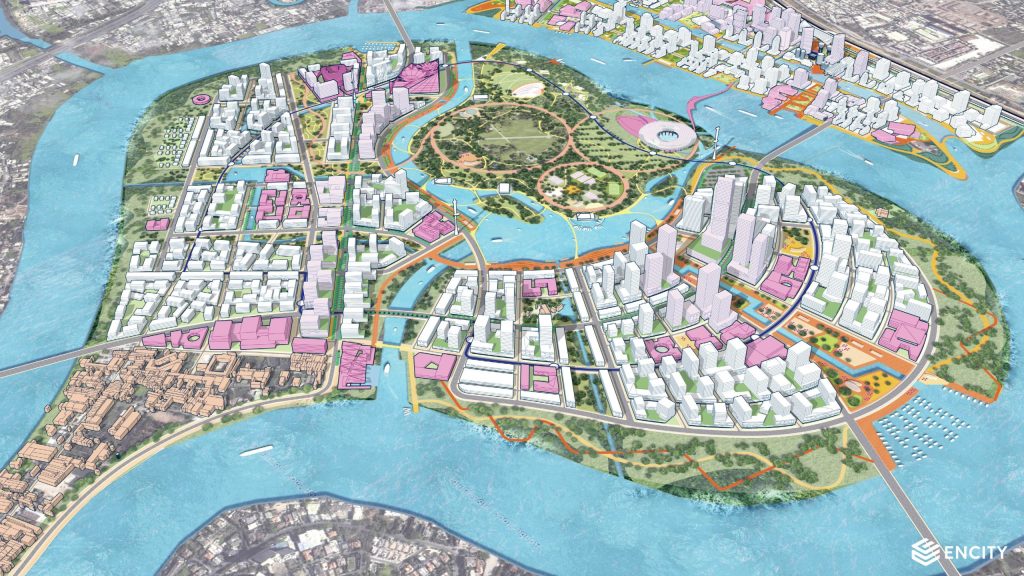
The master plan, proposed by the Sasaki – enCity – UPI consortium, envisions Thanh Da as a new eco-cultural-creative urban center of Ho Chi Minh City. A modern, future-ready hub that honors the riverine landscape, the pioneering spirit of Southern Vietnam, and cultivates a richly diverse and identity-driven urban environment.

 VI
VI