

Context
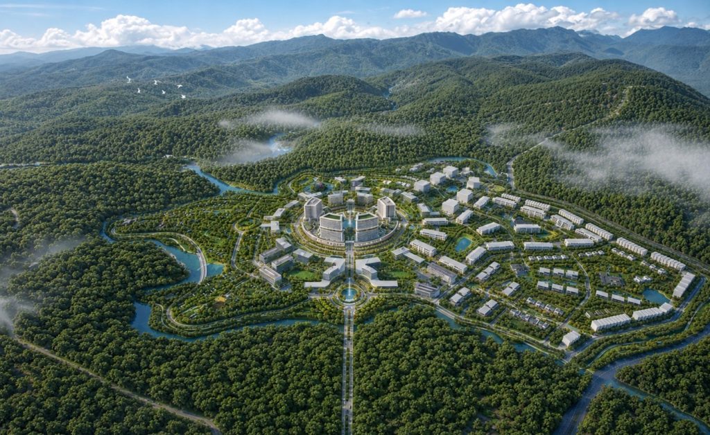
The Pursat Master Plan is envisioned as a new destination community set within the forested landscape of Veal Veng District in western Cambodia. Located close to Route 55 and the Cambodia–Thailand border corridor, the approximately 120-hectare site occupies a strategic position between regional movement routes and some of Pursat Province’s most significant natural assets, including the Meteuk River, Thma Da Waterfall, the Cardamom mountain landscape and the Phnum Samkos Wildlife Sanctuary. This setting gives the project a strong identity rooted in forest, mountain, river and eco-tourism experiences.
The site is defined by an irregular landform surrounded extensively by waterways and natural forest. Elevations range from approximately +212 metres near the northern river edge to +265 metres around the southern arrival area, creating opportunities for long-distance views toward the river, mountains and surrounding landscape. While much of the site is suitable for development, steeper areas—particularly along the northern and eastern edges—require a sensitive planning response that preserves existing slopes, vegetation and natural drainage corridors.
The project must therefore balance two ambitions. The first is to create a commercially viable destination capable of supporting hospitality, tourism, residential, employment and staff accommodation. The second is to protect the qualities that make the site distinctive: its secluded setting, riverfront environment, forest character and elevated views.
The final master plan responds to these ambitions through an integrated programme comprising a central commercial and entertainment core, casino and hotel, food and beverage destinations, shophouses, a water park, indoor amenities, office facilities, accommodation for approximately 10,000 staff, and a diverse range of residential products including standard villas, VIP villas, VVIP villas and glamping villas.
Vision
A River Sanctuary
The vision is to create an exclusive destination community where nature, hospitality, recreation, employment and everyday living are brought together within one coherent environment.
Pursat River Sanctuary will be more than a standalone resort or residential development. It will function as a complete destination ecosystem—a place where visitors can stay, explore and experience the surrounding landscape, while residents and employees benefit from a safe, connected and well-serviced community.
The development will be shaped by the site’s natural identity. River edges, forest landscapes, elevated viewpoints and existing waterways will become the principal elements around which the master plan is organised. Architecture and landscape will be integrated into the terrain, creating a destination that feels embedded within its setting rather than imposed upon it.
At the heart of the project, a memorable commercial and entertainment district will establish a recognisable destination address. Beyond this active centre, the character will gradually transition into quieter residential, wellness and nature-based environments. Riverfront villas, glamping accommodation, community parks and recreational attractions will provide a broad range of experiences, allowing the project to appeal to visitors, families, residents, employees and investors.
The overall ambition is to establish Pursat River Sanctuary as:
A landmark border destination where river, forest and community come together to create a distinctive lifestyle, tourism and entertainment environment.

Strategy
1. Create a Strong Destination Heart
A landmark roundabout and central ring park form the project’s main arrival and activity hub, surrounded by hotel, casino, commercial, dining and entertainment uses.
2. Organise Clear Development Zones
Public and active uses are concentrated at the centre, transitioning toward office, staff accommodation and increasingly private residential areas along the site edges.
3. Maximise Riverfront Value
Villas, VIP residences and glamping accommodation are positioned to benefit from river views, natural surroundings and convenient access from the riverfront road.
4. Connect Nature and Community
Parks, green buffers, waterways and a northern water catchment area create a continuous green-blue network that supports recreation, drainage and environmental protection.
5. Follow the Natural Terrain
Roads and development parcels respond to existing contours to minimise earthworks, reduce environmental impact and create an efficient circulation hierarchy.
6. Build a Complete Destination Community
Hospitality, residential, employment, staff accommodation and recreation are integrated into one master plan, allowing the project to operate as both a tourism destination and a self-sufficient community.

 VI
VI