

Continuing the article introducing the three-layer approach to flood prevention and control for sustainable urban planning in general, this article provides more specific recommendations for cities in the Northern region where severe natural disasters have recently occurred.
Layer 1 – Protection: aiming to isolate inland flooding from residential areas. It can be seen that the cities in Northern Vietnam are generally well protected by the river dyke systems that have been built and improved over hundreds of years. However, when natural disasters occur, some sections of the dyke have experienced overflowing or rupture, causing significant damage to many areas. Therefore, technical solutions such as determining the crest level of the dyke, dyke structure, and dyke maintenance need to be evaluated, researched, and improved.
 Map of the Northern Vietnam dike system (History of Vietnam’s dike system)
Layer 2 – Adaptation: aiming to limit the formation of surface runoff causing flooding from rain through solutions to store and slow down the flow as soon as it rains. Urban flooding has increased significantly in areas with high urbanization rates such as Hanoi. A significant cause is the filling of green spaces, agriculture, or natural ponds to create land for development, leaving rainwater with no space to reside before being drained. Balancing the development land fund and flood storage, along with applying natural-based green infrastructure solutions, will be the next problem to be solved to achieve sustainable urban planning.
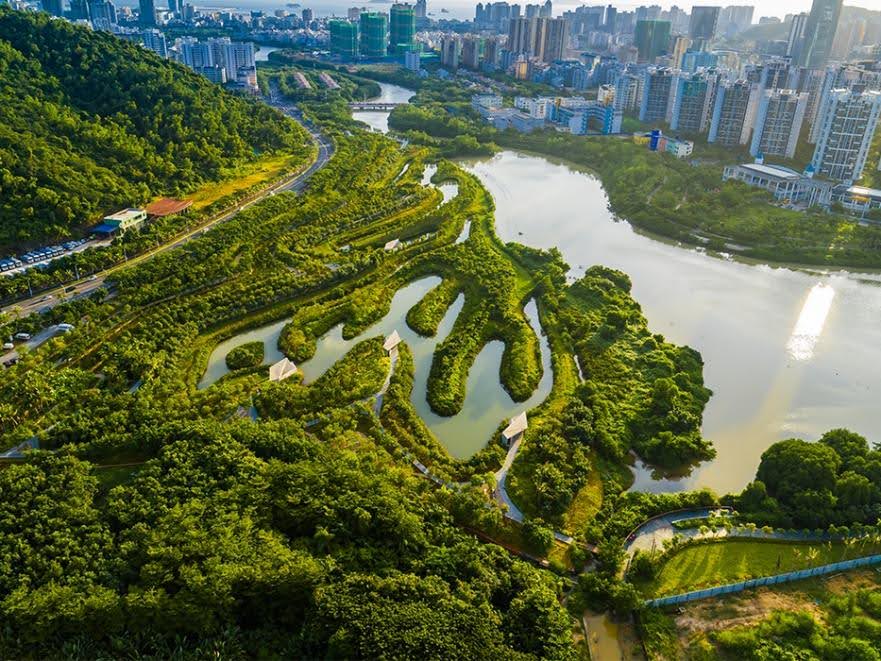 Park with flood storage capacity (Sanya Mangrove Park)
Layer 3 – Damage reduction: as the name suggests, solutions in this layer aim to minimize damage when natural disasters occur. It is undeniable that the formation of concentrated residential areas in areas outside the dyke or in particularly low-lying areas with a high risk of flooding is causing significant damage when natural disasters occur. These areas need strong regulations and sanctions to limit construction and development. In addition, it is necessary to promote the application of technology in forecasting and warning to help people quickly identify dangerous areas and be guided to plan evacuation in time.
 Flood forecasting and warning system developed by Google AI (NewsBytes)
The history of the development of the Northern Red River Delta shows that we have achieved many remarkable successes in controlling the devastation of floods and inundation. However, under the impact of climate change, this form of natural disaster is becoming more severe and leaving unpredictable damage. This requires us to constantly innovate and upgrade our flood control strategies and solutions to develop sustainable cities and adapt well to climate change.

 VI
VI