

Context
A New Waterfront Gateway for Phnom Penh
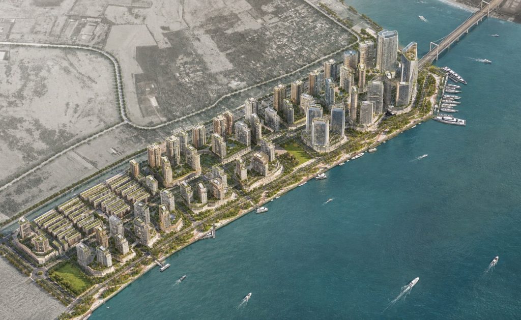
Koh Norea occupies a strategic 70-hectare waterfront site at the meeting point of the Mekong and Bassac Rivers, positioned between Phnom Penh’s established urban core and its expanding eastern districts. With approximately 1.44 kilometres of waterfront frontage, the site benefits from panoramic views towards Diamond Island
New connections towards Diamond Island and National Road 1 establish Koh Norea as an important gateway within Phnom Penh’s emerging “Bay Area Economic Circle.” Surrounded by water yet closely connected to the city, the site presented a unique opportunity to transform a new piece of urban land into a highly accessible, pedestrian-oriented waterfront destination for both residents and visitors.
Vision
The Pearl Island — The World in One City
Inspired by its relationship with neighbouring Diamond Island, the vision reimagines Koh Norea as “The Pearl Island” — another gem along the Mekong River. The concept establishes a distinctive sense of place through architecture, landscape and a diverse sequence of urban experiences, while promoting adaptability, accessibility, resilience and long-term liveability.
The ambition is to create a sustainable, lifestyle-focused satellite city where living, working, leisure, tourism and wellbeing come together within a connected waterfront environment. A vibrant riverfront, landmark destinations, neighbourhood parks and active public spaces transform Koh Norea from a development site into a complete urban community, one that reconnects the city with its rivers.
Strategy
Connecting City, Community and River
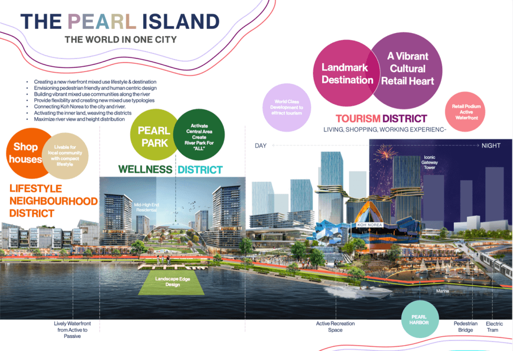
The master plan is structured as a sequence of complementary districts — Tourism, Wellness and Lifestyle Neighbourhoods — each contributing a different character while being connected through a continuous public-realm network. The waterfront evolves from highly active destination spaces to more relaxed neighbourhood environments, anchored by an iconic marina, central park, green corridors and community amenities.
Development intensity and the skyline are carefully orchestrated to maximise river views and reinforce key gateways, with signature buildings creating identifiable focal points. At ground level, the strategy prioritises people: minimising internal roads, strengthening pedestrian connections, introducing electric mobility and water access, and freeing the central areas for car-free green space. A continuous green-and-blue network activates the waterfront promenade and weaves landscape, public space and development together.


 VI
VI