

The consolidation of Binh Duong and Ba Ria-Vung Tau into Ho Chi Minh City has created a mega-metropolis of over 14 million residents spanning nearly 7,000 km² with a radius exceeding 75 km. This administrative expansion has introduced major transportation connectivity challenges.
Despite existing Southeast Regional planning frameworks, the linkage between HCMC’s historic core and peripheral cities remains poor, with travel times exceeding 2 hours, far from optimal for daily commuting. To ensure this mega-metropolis operates efficiently, developing high-capacity public transit systems must be prioritized to reduce travel times to under 1 hour while strengthening connections to airports, seaports, and strategic industrial zones. Concurrently, metro systems previously planned separately for each locality must be integrated to ensure seamless connectivity across the new administrative territory. A synchronized rail network will enable residents and businesses to access services and employment more easily, relieve infrastructure pressure on the urban core, drive sustainable development, and position HCMC as a globally competitive mega-metropolis.

Regional Rail Connectivity: The Key to Bridging Distances to Peripheral Cities
1. An Binh-Thu Thiem: 8km railway for strategic linkages
Pre-consolidation approved plans have established HCMC’s regional rail hub network, comprising the North-South Railway, North-South High-Speed Rail, HCMC-Can Tho Railway, potential Tan Kien-Thu Thiem line, Bien Hoa-Vung Tau Railway, HCMC-Loc Ninh Railway, HCMC-Tay Ninh Railway, Thu Thiem-Long Thanh Light Railway, and the Hiep Phuoc Port connector.
While this system offers substantial potential for rapid peripheral city connections—particularly through the HCMC-Loc Ninh and Bien Hoa-Vung Tau lines—a critical gap persists. Current connections cannot transport passengers from northern peripheral cities (formerly Binh Duong) and southeastern areas (formerly Ba Ria-Vung Tau) directly into central HCMC.
With An Binh functioning as the hub for national railway lines, this connecting segment will complete the entire system, ensuring seamless connectivity from the national rail network to Thu Thiem Station in central HCMC. The approximately 8km connection begins at the intersection of the An Binh-Hoa Hung line with Ring Road 2, follows the Ring Road 2 corridor (67m right-of-way) to Vo Nguyen Giap Road, then continues along the Vo Nguyen Giap Road corridor (>150m right-of-way) and Mai Chi Tho (100m right-of-way) to Thu Thiem Station.
The An Binh-Thu Thiem rail segment will not only connect cities within Ho Chi Minh City’s boundaries but also provide rapid links for regional cities like Tay Ninh (Long An) and Binh Phuoc (Dong Nai) to Thu Thiem—a major regional and national transportation hub. From Thu Thiem, direct northbound travel becomes possible via the North-South High-Speed Rail with direct connections to Long Thanh International Airport.

2. Transforming Vung Tau into HCMC’s Suburban Extension
Currently, travel from central HCMC to Vung Tau requires approximately 1.5-2 hours by road. The Thu Thiem-An Binh-Vung Tau suburban rail line will reduce travel time from Vung Tau to central HCMC to approximately 1 hour. This represents a powerful catalyst that could transform Vung Tau into an “extended suburb” of HCMC, positioning it to accommodate migration and investment flows from the mega-metropolitan center.
Our traffic analysis modeling indicates current travel demand between HCMC and Ba Ria-Vung Tau at 40,000-50,000 passengers daily. By 2035, this demand is forecast to reach 80,000-100,000 passengers daily without a rapid rail system. Under the Thu Thiem-An Binh-Vung Tau scenario, travel demand is projected to increase to 88,000-120,000 passengers daily, with rail capturing 40-45% of total traffic volume through modal shift from road transport and rail-induced demand.
Malaysia’s experience illustrates this potential: the Kuala Lumpur-Seremban rail line (56 km, average speed 80 km/h) reduced travel time to 45 minutes compared to bus (1-1.5 hours), taxi (1 hour), or conventional train (1.5-2 hours). With a 600-seat capacity and 30 daily services, this line served 12,000 passengers daily (1997), capturing 35% of total travel demand—20% shifted from bus, 10% from taxi, and 8% representing new demand. This rail line increased retail revenue in Seremban by 5% and reduced traffic congestion in Kuala Lumpur.
Toward a Seamless, Integrated Metro Network
Each urban area within the new administrative boundaries has independently planned and developed high-capacity public transit systems. To ensure seamless transfers between systems and create a unified network post-consolidation, planning and operational adjustments are required to integrate these systems cohesively.
1. Seamless integration with the Northern urban area
Within a 20-25 km radius from central HCMC, urban rail connections have been identified through planning, including MRT Line 2 from central HCMC to Thu Dau Mot, MRT Line 3 from the city center connecting to former Binh Duong’s Line 2 to Tan Uyên, and MRT Line 1 from the center connecting to former Binh Duong’s Line 1. To optimize efficiency, we propose extending former Binh Duong’s Metro Line 3 to Truong Tho, replacing the MRT Line 6 branch.
Beyond the 25 km radius, public transit lines connecting Cu Chi require review and supplementation, along with adjustments to northern Binh Duong Metro lines. Initially, BRT should serve routes with demand below 15,000-20,000 passengers/hour/direction, with 5-year periodic assessments to evaluate rail conversion potential.

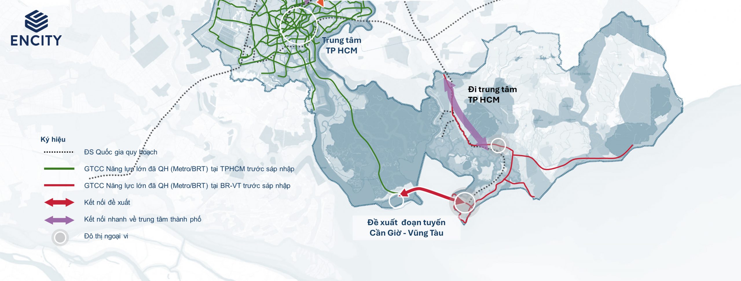
2. Coastal urban area development: connecting Can Gio-Vung Tau
To strengthen southern and southeastern connectivity, we propose extending the HCMC-Can Gio rail line to Ba Ria-Vung Tau, creating entirely new possibilities for coastal urban development. Travel demand between Can Gio-Vung Tau is projected to reach nearly 100,000 trips daily by 2035, driven by development of the Can Gio sea reclamation urban area (2,870 ha; population 228,000), Can Gio transshipment port (571 ha; 6,000-8,000 jobs), and Vung Tau (population 650,000; Cai Mep-Thi Vai port projected at 52.3 million TEU by 2050).
Currently, the Can Gio-Vung Tau ferry route (operational since 2021) serves 8,400 passengers daily with 24 services. Initially, ferry frequency can be increased; as demand grows, rail and road connections should be added.
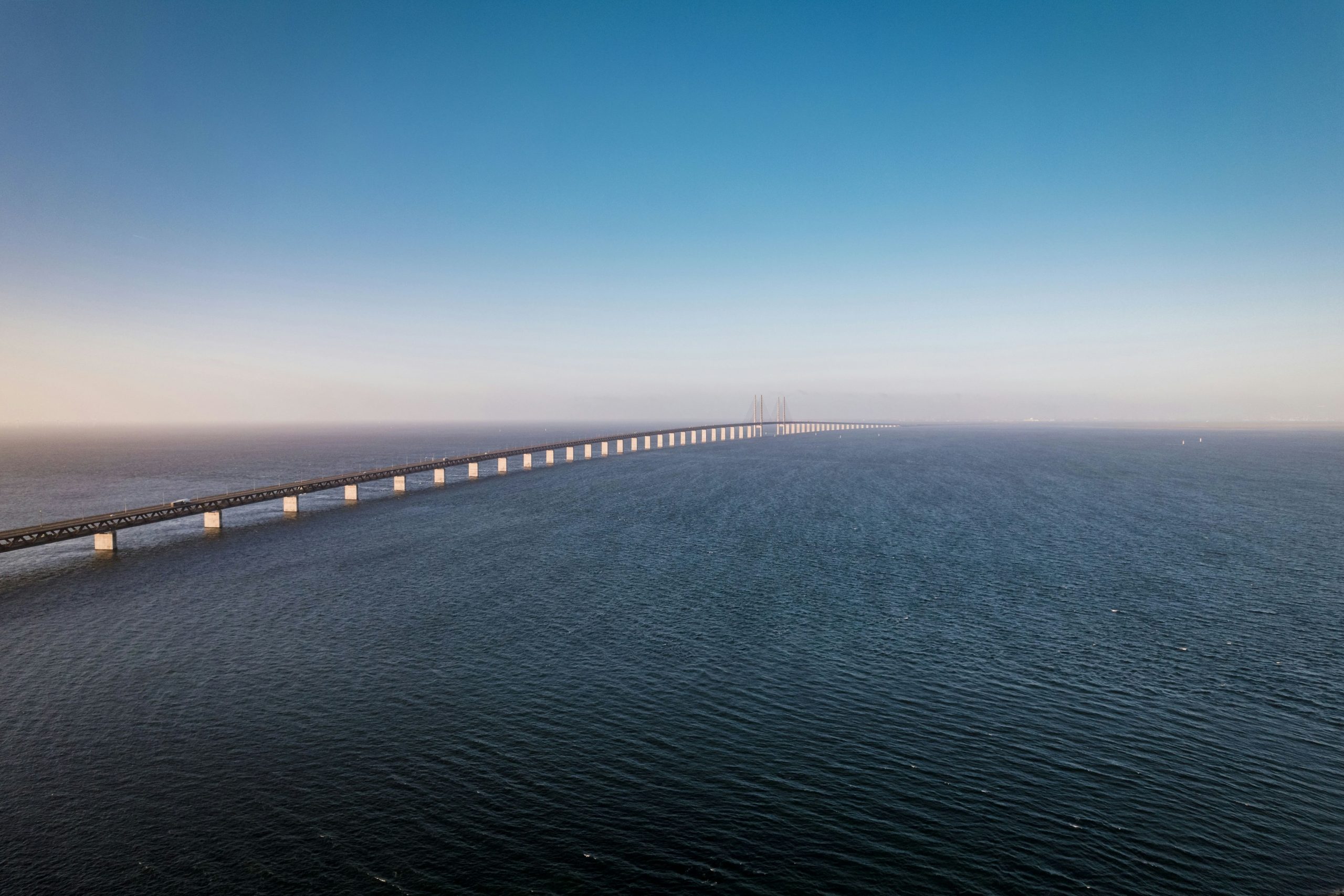
International experience from Denmark and Sweden demonstrates the transformative potential: the Øresund Bridge and Tunnel (8 km) connecting Copenhagen and Malmö reduced travel time from 1 hour by ferry to 35 minutes by train/car. With 24 trains hourly and 19,000 vehicle crossings daily (2019), the bridge generated economic benefits of 78 billion krona (9 billion USD in 2000 values), boosting trade (10-15% annually), labor mobility (20,000 daily commuters), and tourism (2 million passengers annually, contributing 1.5 billion Euro).
The expansion of HCMC through consolidation with Binh Duong and Ba Ria-Vung Tau establishes the foundation for a mega-metropolis with tremendous potential in services, industry, logistics, and tourism. A synchronized urban and regional rail system will prove pivotal in reducing connectivity time between peripheral cities and central HCMC, strengthening national and international linkages, and directly contributing to the emergence of a globally competitive mega-metropolis.
Author: Nen Nguyen, Transportation Infrastructure Senior Associate, enCity

 VI
VI