

Ho Chi Minh City is gradually realising its ambition to build one of Southeast Asia’s largest metro networks – a total planned length of 655 km with an estimated investment of USD 60 billion. Yet, to transform this massive investment into an efficient and sustainable metro system, the city needs one critical strategic foundation: the transport model.
Pre-merger metro planning: A 655 km system and breakthrough strategies
Before Ho Chi Minh City’s administrative merger with Binh Duong and Ba Ria–Vung Tau provinces (effective July 1, 2025), enCity was the lead consultant for the city’s metro system planning under the adjustment of the General Planning to 2040, Vision to 2060. In this plan, enCity proposed developing a 12-line metro network totaling 655 km, identifying metro as the backbone shaping the city’s spatial structure.
Notably, the plan introduced several breakthrough strategies never before seen in HCMC’s transport planning:
- Establishing Transit-Oriented Development (TOD) as a sustainable financing mechanism for metro projects.
- Phasing investments based on actual travel demand and urban connectivity.
- Categorizing metro lines (core – priority – long-term) using quantitative criteria.
- Integrating the network with the extended metropolitan region (including Binh Duong, Dong Nai, and Ba Ria–Vung Tau).
- Linking metro corridors with growth poles and satellite centers.
To realize these strategies, several lines were adjusted to enhance connectivity:
All these breakthroughs were grounded in the transport model that enCity has developed and continuously refined for over a decade.
- Direct integration with the national railway network.
- A new line serving Thu Thiem – the future financial center.
- A closed loop line connecting near-central urban areas.
- More interchange stations to activate TOD at major junctions.

Continuously updated data as the foundation for decision-making
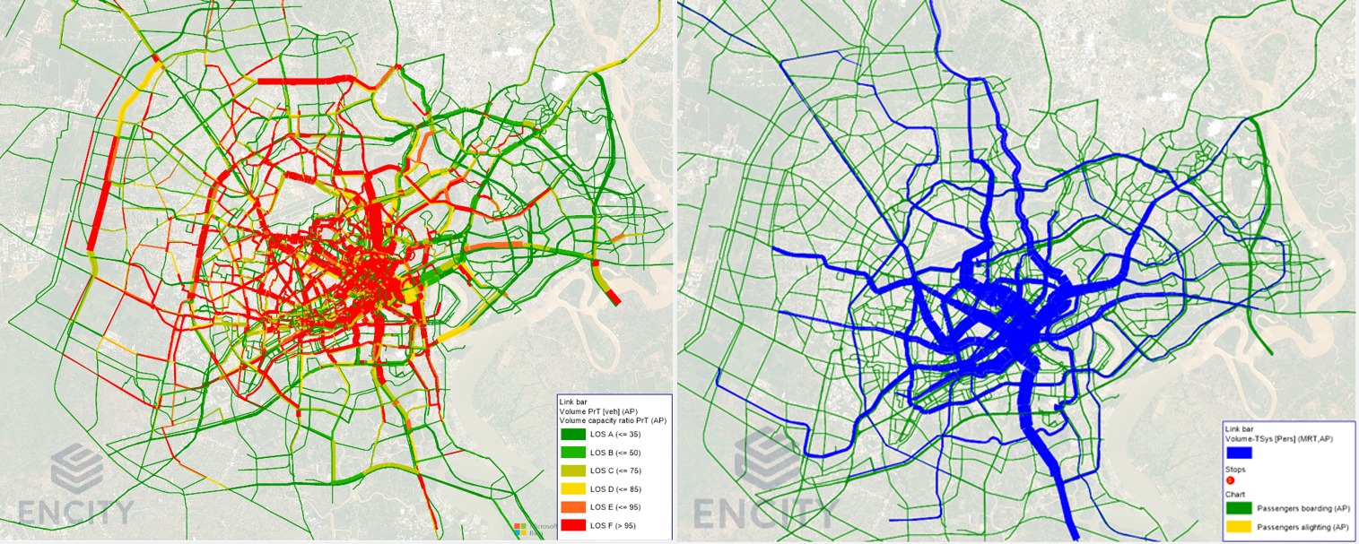
The macroscopic transport model is a key tool enabling enCity to propose evidence-based strategies. It simulates travel behavior across the entire population under approved urban development scenarios, operating through four stages:
- Trip generation and attraction,
- Origin-destination (O-D) distribution,
- Mode split,
- Network assignment.
Its outputs include detailed indicators such as segment traffic volume, station ridership, and modal shift from private vehicles to metro — providing data-driven answers to essential questions:
- With limited resources, which line should be prioritized?
- How should stations be designed to meet 20–30-year demand without overspending?
- How will the metro system affect socioeconomic development and spatial organization?
- Which alignment offers the best balance between demand and investment efficiency?
The enCity team built this model from scratch and has continuously updated it with planning, demographic, and socioeconomic data for more than ten years. It is currently the only quantitative tool capable of connecting long-term planning visions with specific investment decisions — from identifying priority lines and designing stations to guiding TOD development.

Three strategic applications
1. Optimizing and phasing USD 60 billion in investment
With 12 metro lines and 655 km in total length, a key question is which lines and stations deserve priority. The transport model provides quantitative insights to address this.
For instance, enCity is forecasting ridership to inform the technical design of Metro Line 2, providing detailed data for each station. These datasets allow authorities to rank projects by urgency, plan investment phases, and focus resources on high-demand areas. Investors can, in turn, make transparent assessments of return potential and risk.
2. Guiding technical design
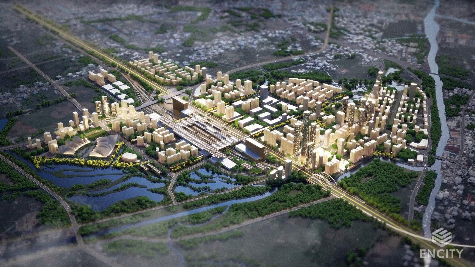
Once a line is approved for construction, the next question is how to design and operate it efficiently. A design that is too small risks overloading and costly upgrades, while one that is too large leads to capital waste. The transport model provides data to balance these trade-offs.
enCity is applying this approach to supply inputs for FEED design of Metro Line 2. Instead of generic assumptions or copying from other lines, the design team uses specific traffic data to optimize every component — from train technology and capacity to station size.
3. Shaping TOD development
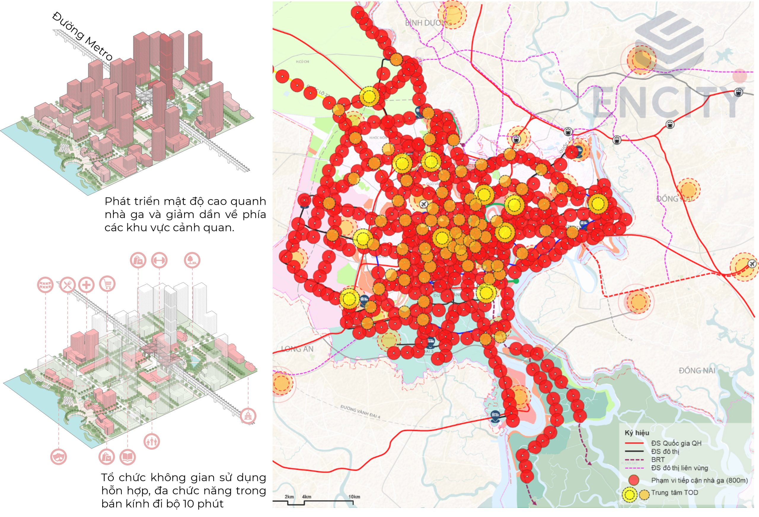
TOD serves as both an engine for urban restructuring and a key financial mechanism. The model helps identify areas around stations with the highest TOD potential — where high passenger volume aligns with land development opportunities and strong infrastructure connectivity. This enables the city to pinpoint “golden zones” for compact, mixed-use, transit-integrated urban growth.
Moreover, the model forecasts behavioral shifts once the metro becomes operational: higher public transport usage, lower parking demand, and greater development intensity. These insights support adjustments to planning indicators, land value capture, and transparent TOD investment.
A continuous decision-making foundation shaping the city’s future
After HCMC’s merger with Binh Duong and Ba Ria–Vung Tau, the metro network is expected to expand beyond 1,000 km, with a total investment of USD 80–100 billion. As the scale multiplies, maintaining and utilizing the transport model becomes more critical than ever.
The macroscopic transport model turns the 655 km metro vision into a quantifiable, phased roadmap — line by line, station by station, stage by stage. It ensures that public transport investment not only addresses mobility but also shapes sustainable urban growth: identifying which lines to prioritize, which stations require large capacity, and which areas to develop under TOD.
To sustain this role, the continuity of the model is essential. With data accumulated over a decade — before and throughout the planning process — it provides unmatched reliability. Ho Chi Minh City must continue using this model as a consistent decision-making foundation, from planning and investment to operation, to transform the USD 60–100 billion investment into a true engine of sustainable urban development.

 VI
VI